The atmospheric circulation over the CONUS during May 2021 was very active with several shortwave troughs and ridges, and closed lows, moving through the jet stream flow. The troughs and closed lows dragged surface lows and fronts with them. The shortwave ridges and troughs stalled a few times during the month, resulting in longwave patterns that were stable for a week at a time. When averaged over the month, the upper-level circulation pattern was fairly westerly with a bit of a trough in the West, but the pattern had above-normal heights which suggested the jet stream was shifted a bit to the north overall.
Canadian air masses frequently moved across the CONUS to the Gulf of Mexico coast and beyond. This contributed to a monthly temperature anomaly pattern of cooler-than-normal temperatures east of the Rockies. Pacific weather systems weakened as they moved across the West, resulting in a mostly drier-than-normal month. They picked up Gulf of Mexico moisture as they moved across the southern and central Plains and, interacting with the surface fronts, left behind above-normal precipitation for the month in these areas. With a variable storm track elsewhere across the country, a few areas in the northern Rockies, northern Plains, South, and Midwest to southern New England ended up with near- to above-normal precipitation for the month, but in general, much of the West, northern Plains to northern New England, Ohio Valley, and Mid-Atlantic to Southeast were drier than normal for May.
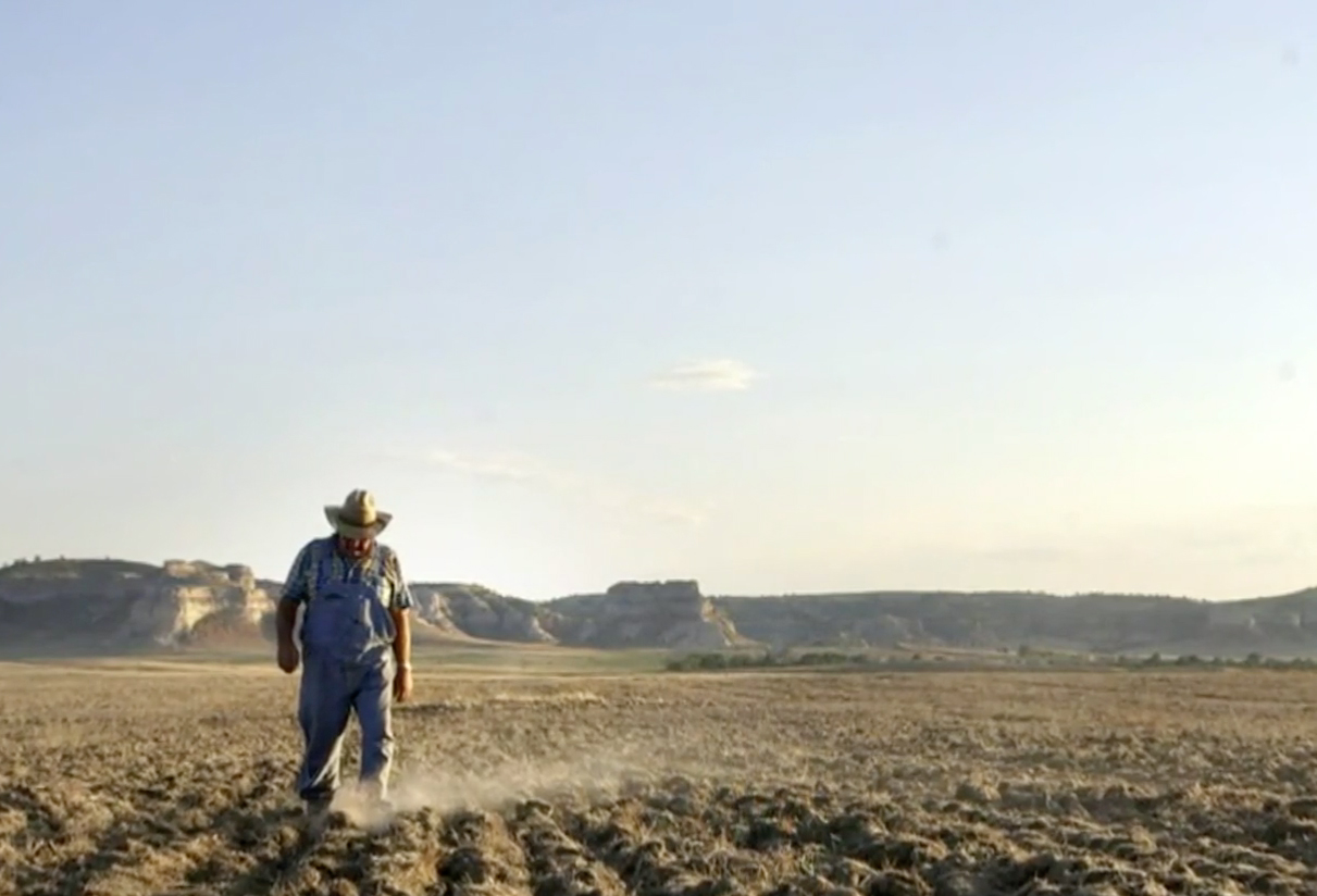
The below-normal precipitation during May and for the last several months, and below-normal mountain snowpack in the West, have resulted in low to record-low streamflow, low groundwater levels, and dry soil moisture.
These conditions were especially notable across the West, Great Lakes and Ohio Valley states to Northeast, western Texas, Mid-Atlantic to Southeast states, and parts of the northern Plains and Iowa. The month began with large wildfires occurring in the Southwest; as the month progressed, they expanded in the West and some developed in southern Florida with total acreage burned for the year to date of about 680 thousand acres, which is below average.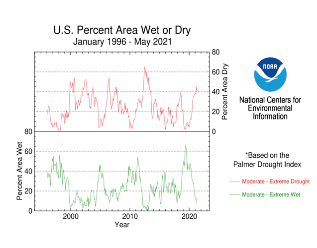
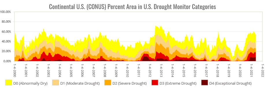
As a result of these conditions, drought or abnormal dryness expanded or intensified in the Far West, Mid-Atlantic states, and parts of Florida and the Upper Mississippi Valley. Beneficial rains caused drought or abnormal dryness to contract or decrease in intensity in parts of the northern and central Rockies, Great Plains, and Midwest to Northeast. Drought contraction exceeded expansion with the USDM-based national moderate-to-exceptional drought footprint across the CONUS falling from 48.4 percent at the end of April to 43.7 percent at the end of May (from 40.4 percent to 36.5 percent for the 50 States and Puerto Rico). According to the Palmer Drought Index, which goes back to the beginning of the 20th century, about 41.0 percent of the CONUS was in moderate to extreme drought at the end of May, a decrease compared to the end of April. The percent area of the CONUS in moderate to extreme drought has hovered between 35 and 45 percent for the last nine months (since September 2020).
For the full article: NOAA- National Centers for Environmental Information