Screening Eagle Technologies provides a unified platform of inspection sensors, software and data to protect the built world. Its subsurface products allow to effortlessly locate and map buried utilities. Its ultra-wideband GPR technology provides a high-resolution 3D image. This is paired with powerful software and advanced positioning technologies.
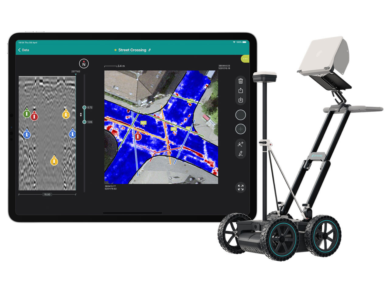
Now, surveyors, locators, and mapping professionals can enjoy 3D maps of the underground building in real-time during the scanning process, and they are no longer constrained by a grid but can walk freely. This revolutionary function is called ‘Free Path’. Furthermore, findings obtained with other techniques can be plotted on the same map as the GPR results, and maps can be delivered directly from the field.
The Proceq GS8000 has an in-built GNSS receiver and its software facilitates corrections over the internet (via SSR or NTRIP RTK) to get accurate location data, in a streamlined workflow.
However, there are times when this is not feasible because of poor satellite or internet coverage. An alternative solution in these situations is to connect a Robotic Total Station to the Proceq GS8000 and enjoy ‘Free Path’ this way.
Source: Screening Eagle